A high pressure system that had planted itself over the Four Corners in early August blocking seasonal rains has drifted east, allowing some moisture to come in – at least for now.
The absence of afternoon storms typical to monsoon season begged the question: had the Southwest missed out?
Now, it seems the answer is an equivocal “no.”
“We have tapped into the monsoon region, and that monsoon moisture has been drawn up into (the) Four Corners a lot more efficiently than it was earlier,” said Dennis Phillips, a meteorologist with the National Weather Service in Grand Junction.
The months of July and August have historically brought about persistent afternoon showers to the region. This year, July and the first week of August were notably dry.
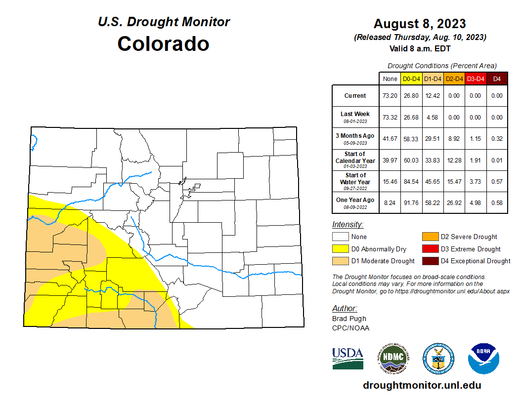
On July 11, the U.S. Drought Monitor recorded that 99% of the Grand Junction Office’s forecast region was not in drought conditions. By July 18, only 54% of the region was not in a state of low-level drought.
Moisture totals for the month of August in Durango and Cortez are still down, Phillips said.
Cortez has received 0.59 inches of precipitation this month, which is over half an inch below normal. Durango has received 0.31 inches, which is 0.7 inches below the normal amount.
However, Phillips warned that those numbers do not totally hold water, as they fail to paint a full picture of rainfall over the entire region.
“The monsoon is kind of fickle like that,” Phillips said. “The monsoon doesn't mean everybody's going to get heavy rainfall, unfortunately, just selective people get under a storm.”
According to crowdsourced data on the Community Collaborative Rain, Hail and Snow Network, outlying regions surrounding Durango have received closer to 0.6 inches in just the last week.
Still, drought conditions have spread in the southwest corner of the state, showing the delayed impact that rain can have on drought conditions.


Looking ahead, Phillips said the moisture expected over the weekend will likely be the last the region sees for a little while.
“That high (pressure system) that's sitting over the plains is getting pushed back to the West and that pretty much shuts everything off,” Phillips said. “I see that happening by early next week – so it definitely looks like a drier forecast going into next week.”
rschafir@durangoherald.com


